Understanding Redwoods National and State Parks
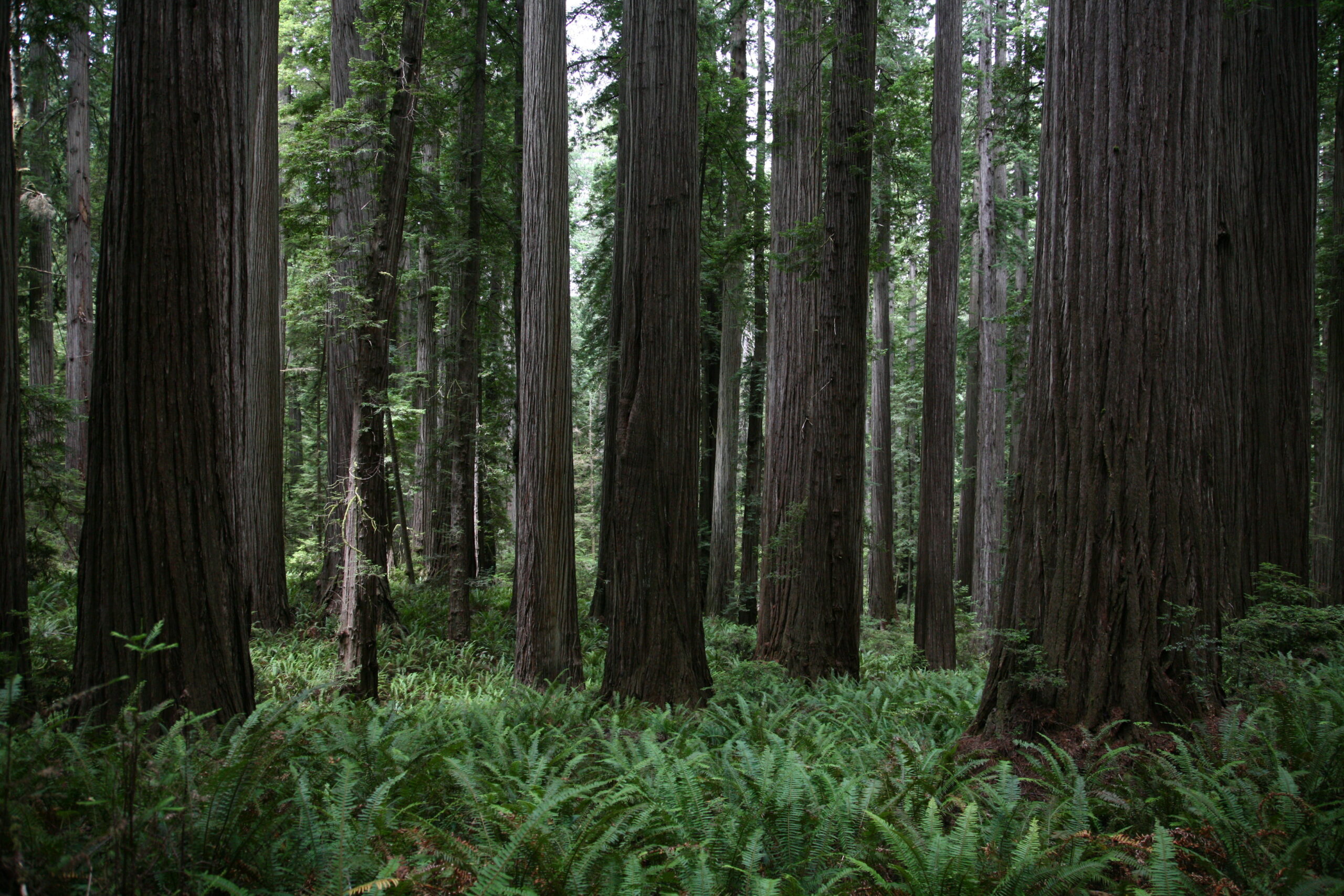
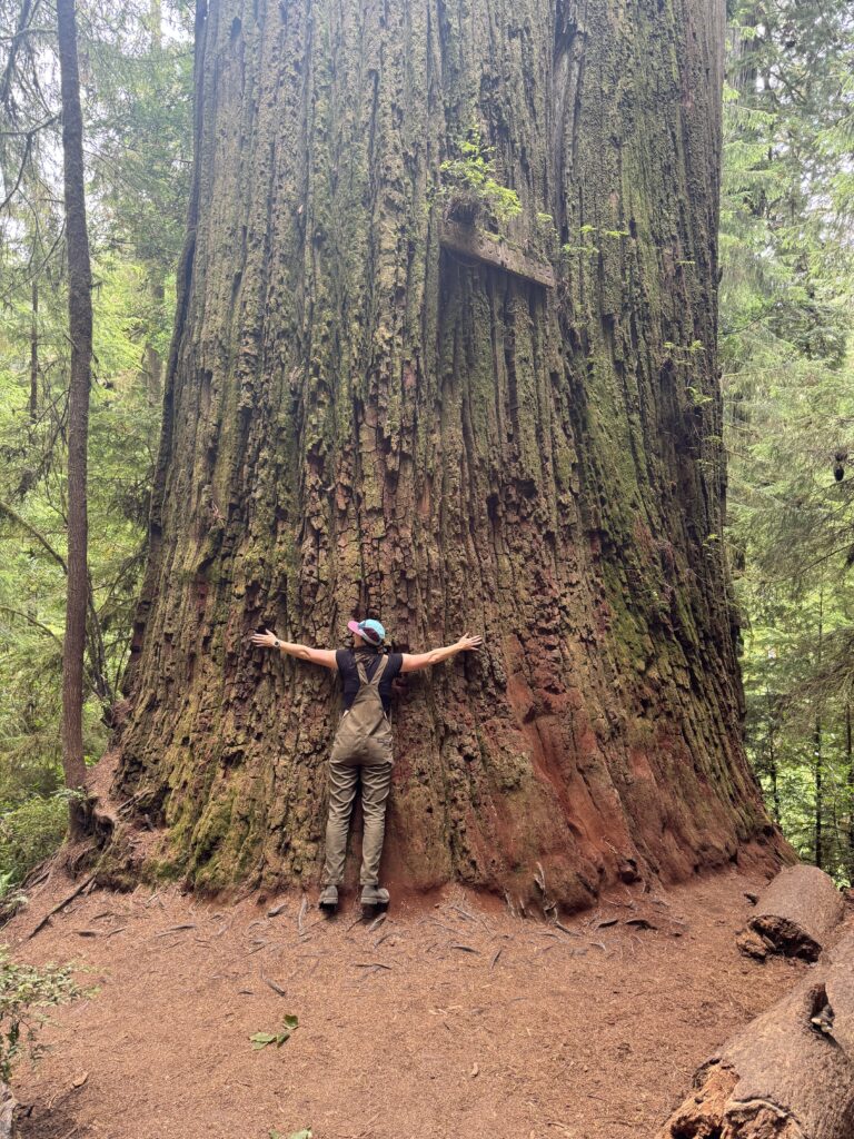
For as long as I can remember, I’ve been mesmerized by trees. Growing up in northern Illinois, my backyard was a forested playground where I spent countless hours exploring with my siblings—or wandering off on my own little adventures. So when I learned that the California coast is home to the tallest trees on Earth, soaring up to 370 feet (taller than the Statue of Liberty), I knew one day I had to stand among them. Planning a California Redwoods National Park travel guide had been on my mind for years, and it was only a matter of time before visiting this park shifted from a wish to reality.
For official information on visiting, maps, park hours, and regulations, check out the Redwoods National and State Parks official website.
I’ve dreamed of visiting these ancient giants — some of which are between 1,000 and 2,000 years old — since high school. After an eleven-year wait, I can confidently say it was well worth it. If you’ve been following my blog, you know that along with sharing my favorite hikes, lodging options, and park highlights, I also love diving into the park’s history — uncovering what truly makes each place so special. If history and science aren’t your thing – feel free to skip down to “Spending 5 Days in Redwoods National Park” section below.
History of Redwoods National and State Parks
When I was planning my trip, I found the park structure a bit confusing. Redwoods National and State Parks (RNSP) is co-managed by the National Park Service and California State Parks. In the early 20th century, logging destroyed about 95% of the original old-growth redwoods. To protect what remained, California created state parks like Prairie Creek, Del Norte Coast, and Jedediah Smith Redwoods in the 1920s–30s. Later, the U.S. Congress established Redwoods National Park to preserve additional lands and watersheds. Today, the National Park Service and California State Parks manage these areas together, which is why “Redwoods National Park” actually includes several smaller state parks.
Fun fact: Together, the Redwoods National and State Parks protect 45% of all remaining old-growth redwoods in the world!


Fire and the Redwoods: A Surprising Relationship
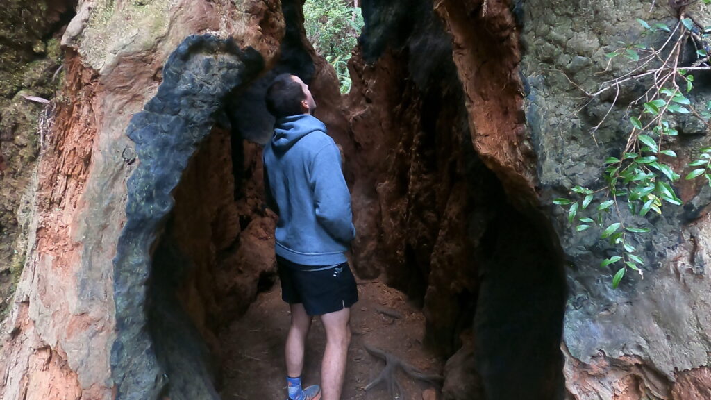
When most people think “forest fire,” they think destruction—but redwoods are different. These giants are fire-resistant, with bark up to 12 inches thick. Rich in tannin, the bark naturally defends against insects, fungi, bacteria, and even slows decomposition, helping them survive for thousands of years.
Resilience Through Fire
Even trees scarred by flames can sprout new growth from their base or trunk through basal burls—knobby growths of dormant buds that regenerate after damage.
Why Fire is Important
Redwoods’ height keeps their vital canopy out of reach of flames, and periodic fires play a key ecological role: they clear undergrowth, recycle nutrients, open the canopy, and control pests and disease.
“When you stand inside a hollow, fire-scarred redwood, you’re literally seeing history. That tree has not only survived fire — it has thrived because of it.”
Coastal Hazards: Earthquakes and Tsunamis at Redwoods National and State Parks
The Northern California coast is shaped by dramatic geological forces, and earthquakes and tsunamis are a real concern for visitors. During our stay, we experienced a moment of panic when our phones buzzed with an emergency alert:
“EMERGENCY ALERT – The National Weather Service has issued a TSUNAMI WARNING. A series of powerful waves and strong currents may impact coasts near you. You are in danger. Get away from coastal waters. Get to high ground or inland now.”
This alert was triggered by an 8.8 magnitude earthquake off Russia’s Kamchatka Peninsula on July 30th, 2025.
Feeling Unprepared
As a Midwest native now living in Colorado, I’m familiar with forest fires and tornadoes—but tsunamis? Not so much. The alert left me uneasy at our quiet campsite. With no cell service and seeing no one else panicking, I reluctantly settled in for the night, trusting that park authorities would intervene if we were truly in danger.
Learning on Location
The next evening, a park ranger gave a talk on earthquakes and tsunamis at the campground amphitheater. After the alert, I couldn’t pass up the opportunity to learn more. Whether the talk was planned or adapted because of the alert, it was perfectly timed—and I walked away with a much better understanding of the risks along the California coast and how to stay safe while enjoying Redwoods National and State Parks
Earthquakes and Tsunamis in Redwoods National and State Parks
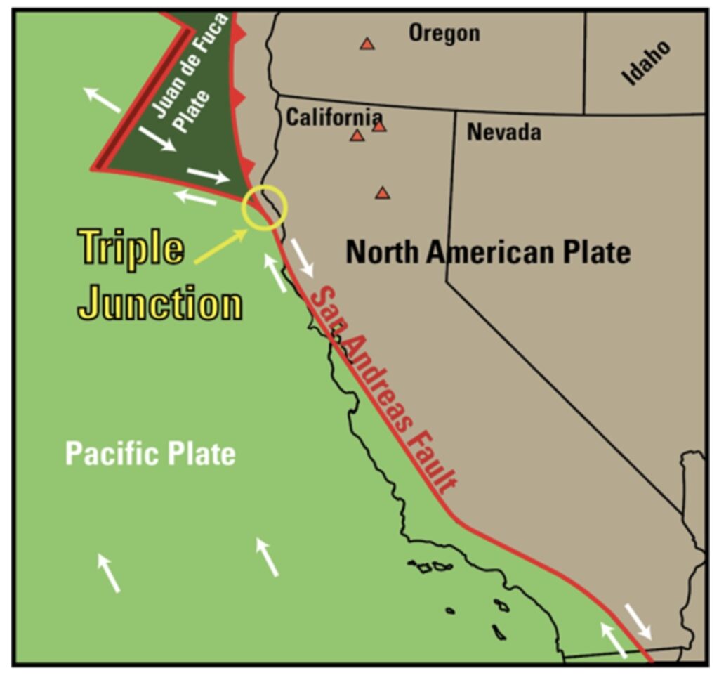
Redwoods National and State Parks (RNSP) sit near the Mendocino Triple Junction, where the Pacific Plate, Gorda Plate, and North American Plate converge. This area, just south of Eureka, California, is one of North America’s most seismically active regions.
The Cascadia Subduction Zone, which runs from Northern California to British Columbia, includes the Juan de Fuca Plate (and the Gorda Plate near California) slipping beneath the North American Plate. This process can cause powerful earthquakes, sometimes offshore, creating a risk of tsunamis for park visitors.
Low-lying areas like Gold Bluffs Beach and Crescent Beach are especially vulnerable. During our visit, a tsunami alert prompted evacuation of Gold Bluffs Beach Campground, with some campers redirected to Prairie Creek—keeping everyone safe. These events highlight the importance of knowing emergency procedures and moving to higher ground when necessary.
On average, Cascadia megathrust quakes happen every 300–600 years. Since the last one was in 1700, we are within the window for the next. That doesn’t mean it will happen tomorrow — but it could.
The Northern California coast is breathtaking and inspiring, yet it can turn perilous in an instant if caught in the path of a natural event. Nature demands respect.
5-Day California Redwoods National Park Travel Guide:
Redwoods National and State Parks (RNSP) has been a bucket-list destination for nature lovers and hikers alike. To fully experience the giant trees and ancient forests, I recommend dedicating at least three days to explore the park.
The park has five visitor centers—Hiouchi, Jedediah Smith, Crescent City, Prairie Creek, and Thomas H. Kuchel—each offering maps, hiking tips, and park information. The Thomas H. Kuchel Visitor Center, located right on the Pacific Ocean, comes highly recommended by park rangers, though we missed it during our drive after a seven-hour trip from San Francisco.
There is no entrance fee for RNSP, excluding Gold Bluffs State Park and Fern Canyon, and most hikes are fully accessible without entering fee areas. So if you don’t have a National Parks Pass—no worries!
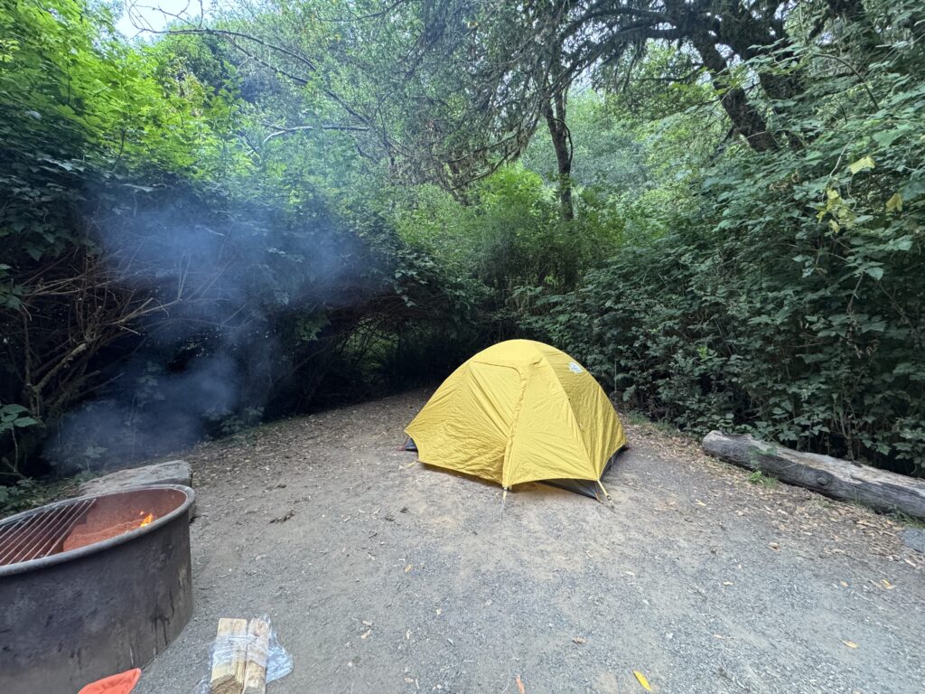
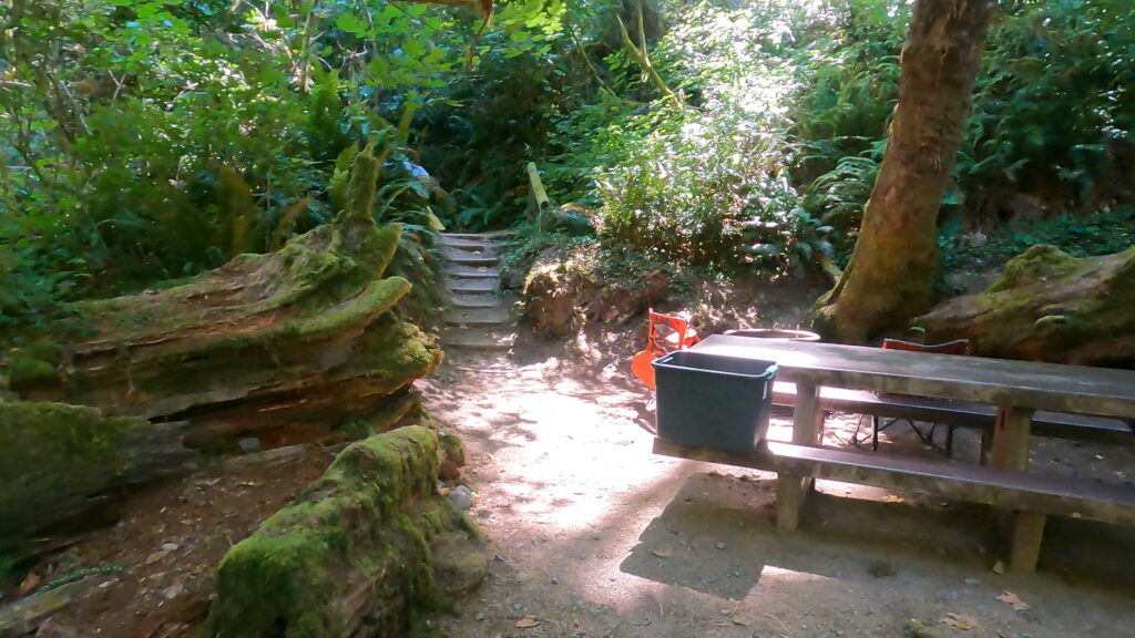
Guide to Camping in Redwoods National and State Parks
There are four campgrounds inside the park, all managed by the California State Parks System: Jedediah Smith, Prairie Creek, Gold Bluffs Beach—which are open year-round—and Mill Creek, which is open during the summer. We stayed two nights at Prairie Creek and three nights at Mill Creek, and both were amazing, surrounded by redwoods in every direction. That said, we especially fell in love with our campsite at Mill Creek
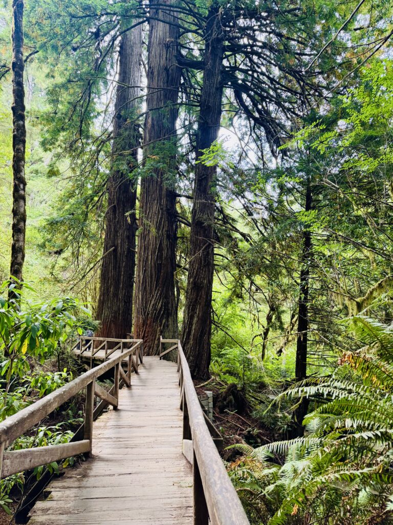
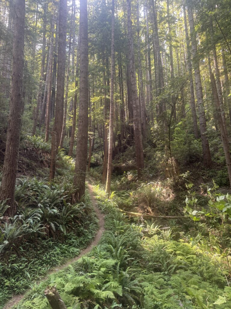
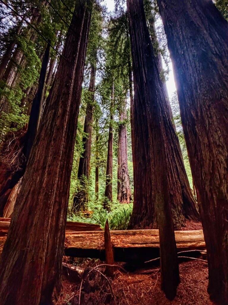
Hiking Among the Giants
Hiking in this ancient forest felt like stepping into a daydream—something you can only truly understand by experiencing it for yourself. You can’t fully grasp the presence of these giants until you’re surrounded by them in every direction. Man, if these trees could talk! Every trail we explored was unique, quaint, and immense all at once, and hiking here was such a lovely experience. The park felt surprisingly laid back, never overly crowded, and since the redwoods are the main attraction (and truly everywhere), each hike felt like the best hike ever. Of course, there are some more popular trails like Fern Canyon (which requires a reservation permit) and the Boy Scout Tree Trail, but even those felt more relaxed compared to hikes in other national parks.
I’ll admit—I can get caught up in over-planning my hikes before a trip, which sometimes makes the experience feel a little too scripted. But this time, I kept just a few trails in mind and let each day unfold naturally. It was such a refreshing change, and it reminded me that sometimes, getting off the beaten path is exactly what you need. Looking for some hiking inspiration? Here are a few of the trails we explored!
Karl Knapp
Location: Prairie Creek Redwoods State Park
Length: 4 miles
Difficulty: Easy
Notes: Trailhead is located near the Visitor Center – since we were camping here we just walked from our campsite to the trailhead! We took the Karl Knapp trail all the way past the Corkscrew Tree and eventually crossed the road and connected on the Foothill Trail where we headed towards Big Tree Wayside! Then we continued back towards the visitor center making our specific route a 6.2 mile loop!
Boy Scout Tree Trail
Location: Jedediah Smith Redwoods State Park
Length: 2.8 miles (one-way)
Difficulty: Moderate
Notes: This trailhead was busier than most we explored, but it ended up being my favorite hike in the park. Even the drive there was an adventure, winding through endless twists and turns beneath towering redwoods. The hike itself was incredibly serene, leading to the famous Boy Scout Tree—an absolutely MASSIVE giant that left me in awe
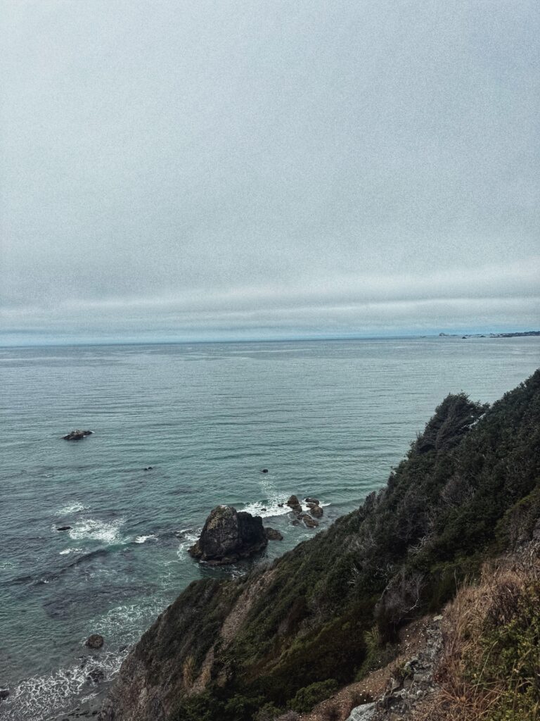
Coastal Trail (Crescent Beach Section)
Location: Crescent Beach picnic area on Enderts Beach Road off Hwy 101
Length: 3.5 miles
Difficulty: Easy
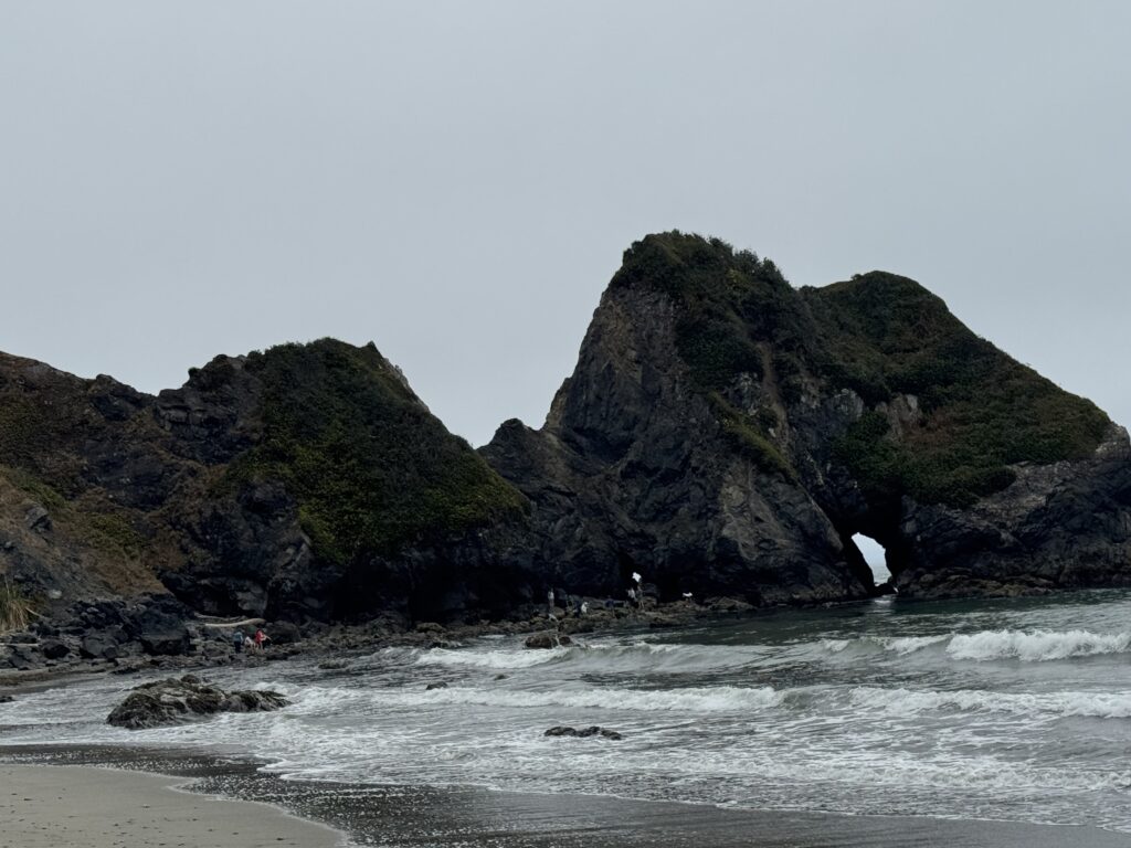
Notes: This hike felt completely different from the others we did in the park, as the trail followed the coastline and offered incredible scenery. Starting near Crescent Beach, the path led us to a secluded stretch of sand where some people were swimming—but the real highlight was exploring the tidepools, spotting crabs, starfish, and all kinds of sea life. The trail does continue beyond the beach, but it gets tough quickly, climbing steeply uphill. After gaining over 1,000 feet in elevation, we finally decided to call it and head back to the car.

Hobbs-Wall Trail
Location: Del Norte Coast Redwoods State Park.
Length: 3.75 miles
Difficulty: Moderate
Notes: We were able to access this trail directly from our campsite in Mill Creek and it was spectacular! After settling in at Mill Creek we saw the trailhead was located right next to our site (big score!) We started at the Trestle Loop Trailhead and from there we joined the Saddler Skyline Trail, then we jumped on Hobbs-Wall Trail which then eventually connected us to the Nature Loop and back on Saddler Skyline Trail and then back on Trestle Loop trail to end up back at our original trailhead (and our campsite). The whole trip was about 5.35 miles and saw only a handful of other people. I used my GAIA GPS app to help connect all the trails to form this loop.
James Irvine Trail
Location: Prairie Creek Redwoods State Park
Length: 4.2 miles
Difficulty: Moderate
Notes: This hike was high on my radar since it’s a bit longer and more challenging than some of the others, and it also offered a way to bypass the reservation system for the famous Fern Canyon. Unfortunately, because of the tsunami alert during our trip, Fern Canyon was closed due to its proximity to the coast. We didn’t get to check this one off the list—but hopefully we’ll be back to complete it someday!
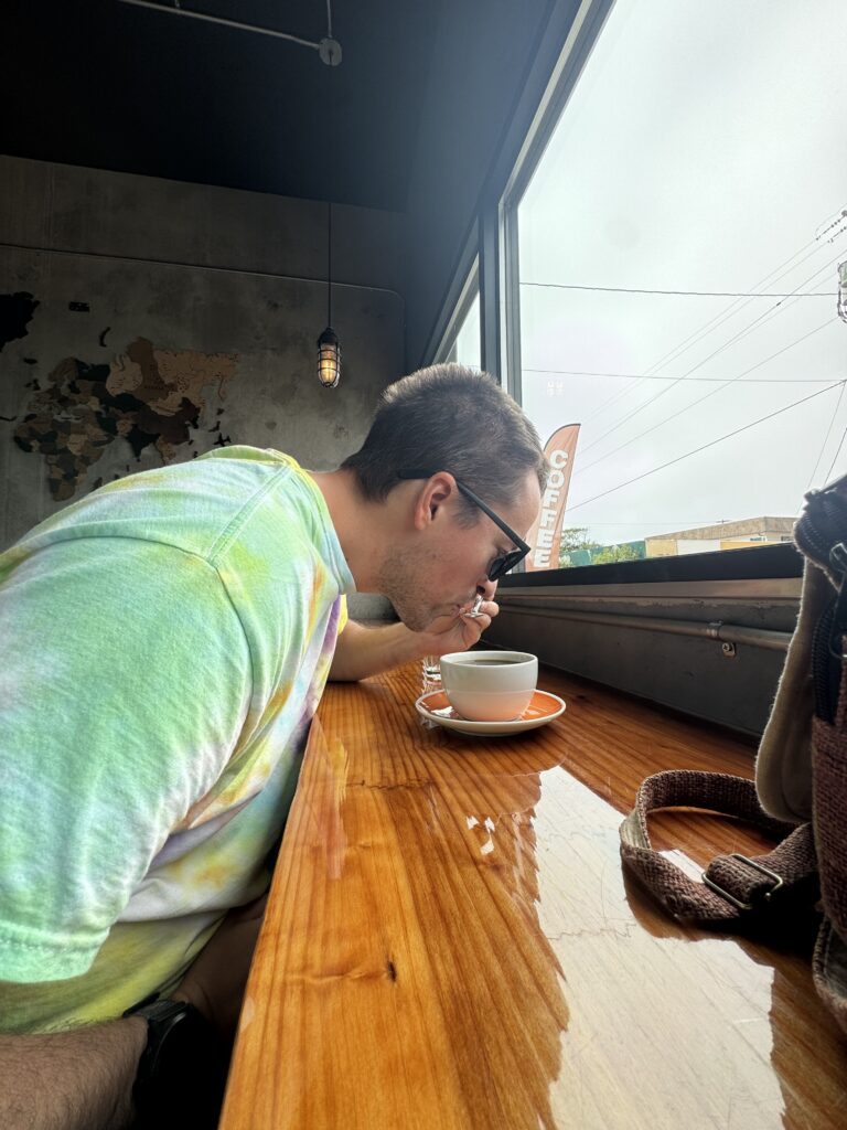
Eating & Coffee:
I love checking out new coffee shops when I travel, and Paragon Coffee House in Crescent City definitely delivered—both with amazing coffee and an adorable atmosphere. We ended up visiting 2–3 times during our short five-day stay, and by the end of the trip, it felt like we were regulars. Saying goodbye was harder than I expected.
Even though we were tent camping inside the park and cooked most of our meals over the campfire, we ventured into Crescent City a couple of times for lunch after a morning of hiking and exploring. We ate at SeaQuake Brewing twice – because when you find a spot with great food, drinks, and atmosphere, why not go back? I highly recommend stopping at both Paragon Coffee House and SeaQuake Brewing if you find yourself in Crescent City with an empty stomach and a caffeine craving 🙂


Thinking of your next National Park Adventure? Don’t wait – contact me today to help piece your adventure together and seize the day! Follow me on Instagram: @ HighDesertHorizons
Leave a Reply